Springe zum Inhalt

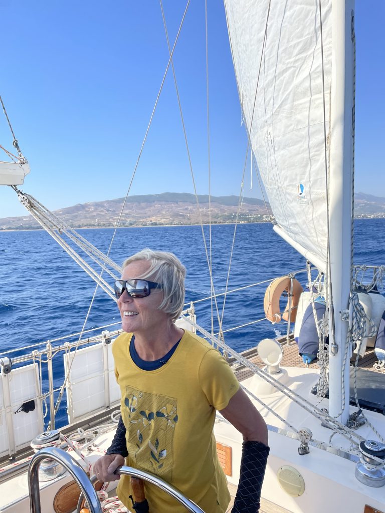
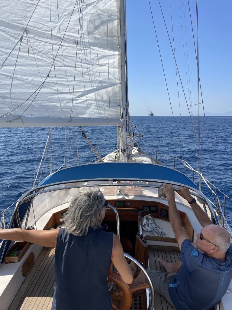
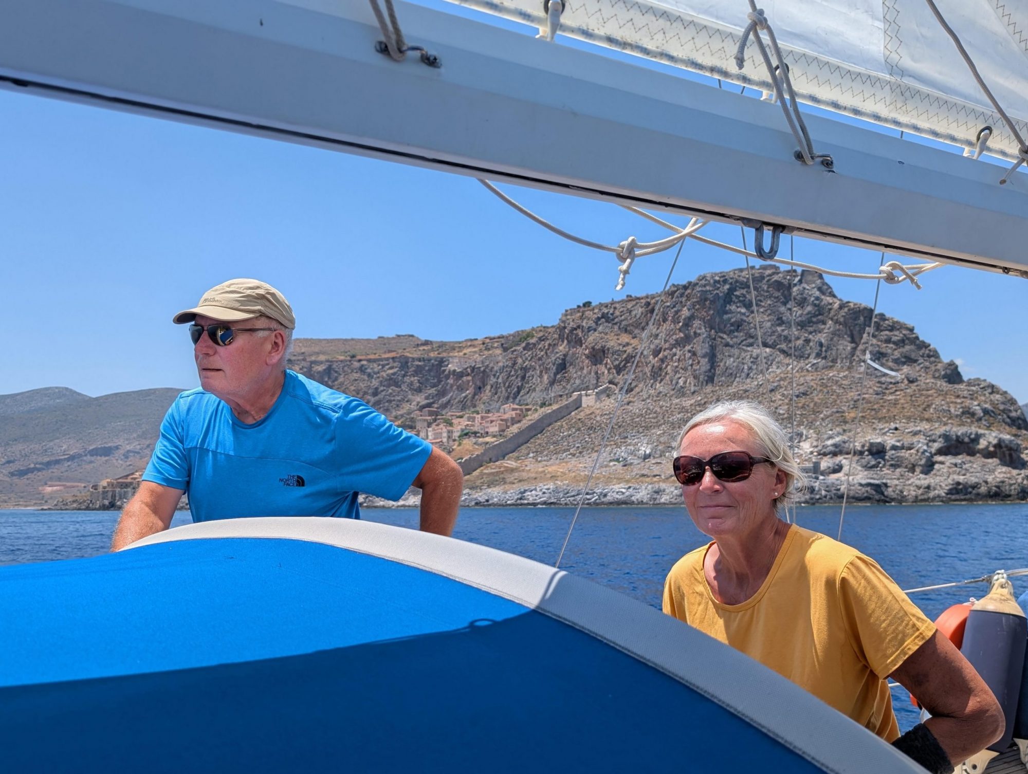
We were on our way a good 40 nautical miles from Kardamena. Our destination: Astypaleia. We really wanted to visit this island. First we sailed along the south coast of Kos with a nice sailing wind. Then the wind shifted more to the north and a strong swell meant that we could not keep the direct course to Astypaleia. So that we could still arrive before nightfall, we motored the last stretch.

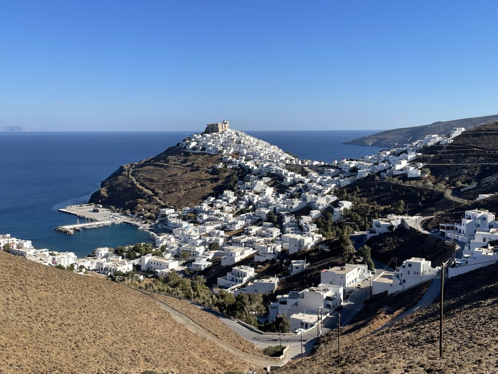
Astypaleia is certainly one of the most beautiful islands in the Aegean. It has the shape of a butterfly with a width of only 100m at its narrowest point and a total extension of about 25 by 15 km. The Chora, white Cycladic houses with a brown castle on top, towers majestically above the tiny old harbour (a maximum of 12-14 boats fit in). The castle was not built by crusaders or Ottomans, it was part of the village and protection against pirates. You can see this landmark from almost every point on the island. There are also eight windmills opposite, but they are no longer in use. 

We wanted to rent a car, but then realised that the landscape is so beautiful that it is best to walk: Rusty brown shining hills with many deeply cut dry valleys, now and then green olive trees, in contrast to the deep blue or turquoise green water in the countless bathing bays. Barren landscape, partly karst, overgrown with millions of silver thistles, now shining golden, and various hard prickly salt weeds. At the confluence of several valleys, a freshwater reservoir, dammed up to store water. All the hills (up to 500m high) are criss-crossed by gravel tracks and goat paths - sometimes it sounds like in the Alps: the goats carry bells. You walk on the gravel tracks and paths far up the heights with gigantic views. Only the old mill, which stands on a central vantage point and has been converted into a cocktail bar, was unfortunately closed due to the end of the season. 

The harbour is small and familiar, surrounded by a few bars and cafés where the locals sit - you hardly see any tourists here. In short: an idyll. We stayed for a whole week and it was hard to say goodbye.

[ngg src="galleries" ids="38" display="basic_slideshow"]
Gut 40 Seemeilen waren wir von Kardamena aus unterwegs. Unser Ziel: Astypaleia. Diese Insel wollten wir unbedingt besuchen. Erst ging es entlang der Südküste von Kos bei schönem Segelwind. Dann drehte der Wind mehr auf Nord und eine starke Dünung führte dazu, dass wir den direkten Kurs auf Astypaleia nicht halten konnten. Damit wir noch vor Einbruch der Dunkelheit ankommen konnten, motorten wir das letzte Stück.

Astypaleia ist bestimmt eine der schönsten Inseln in der Ägäis. Sie hat die Form eines Schmetterlings mit nur 100m Breite an der schmalsten Stelle bei einer Gesamtausdehnung von etwa 25 mal 15 km. Über dem winzigen alten Hafen (maximal 12-14 Boote passen rein) thront majestätisch die Chora, weiße Kykladenhäuschen mit brauner Burg obendrauf. Die Burg ist nicht von Kreuzfahrern oder Osmanen gebaut, sie war Teil des Dorfes und Schutz vor Piraten. Von fast jedem Punkt auf der Insel sieht man dieses Wahrzeichen. Außerdem stehen gegenüber acht Windmühlen, die aber mittlerweile nicht mehr in Betrieb sind. 

Wir wollten uns ein Auto mieten, haben dann aber festgestellt, dass die Landschaft so schön ist, dass man am besten wandert: Rostbraun leuchtende Hügel mit vielen tief eingeschnittenen Trockentälern,  ab und zu grüne Olivenbäume, im Kontrast dazu das tiefblaue oder türkisgrüne Wasser in den unzähligen Badebuchten. Karge Landschaft, teilweise Karst, bewachsen mit Millionen von Silberdisteln, die jetzt allerdings golden glänzen, und verschiedenen harten stacheligen Salzkräutern. Am Zusammenfluss von mehreren Tälern ein Süßwasserstausee, aufgestaut zum Wasserspeicher. Die ganzen Hügel (bis 500m hoch) durchzogen von Schotterpisten und Ziegenpfaden - manchmal klingt es wie in den Alpen: die Ziegen tragen Glocken. Man läuft auf den Schotterpisten und Pfaden weit auf den Höhen mit gigantischen Ausblicken. Nur die alte Mühle, die auf einem zentralen Aussichtspunkt steht und die zur Cocktailbar umgebaut ist, hatte wegen Saisonende leider geschlossen. 

Der Hafen ist klein und familiär, drumherum einige Bars und Cafés, in denen die Einheimischen sitzen - Touristen sieht man hier kaum. Kurz gesagt: eine Idylle. Wir sind eine ganze Woche geblieben, der Abschied fiel schwer.

[ngg src="galleries" ids="38" display="basic_slideshow"]
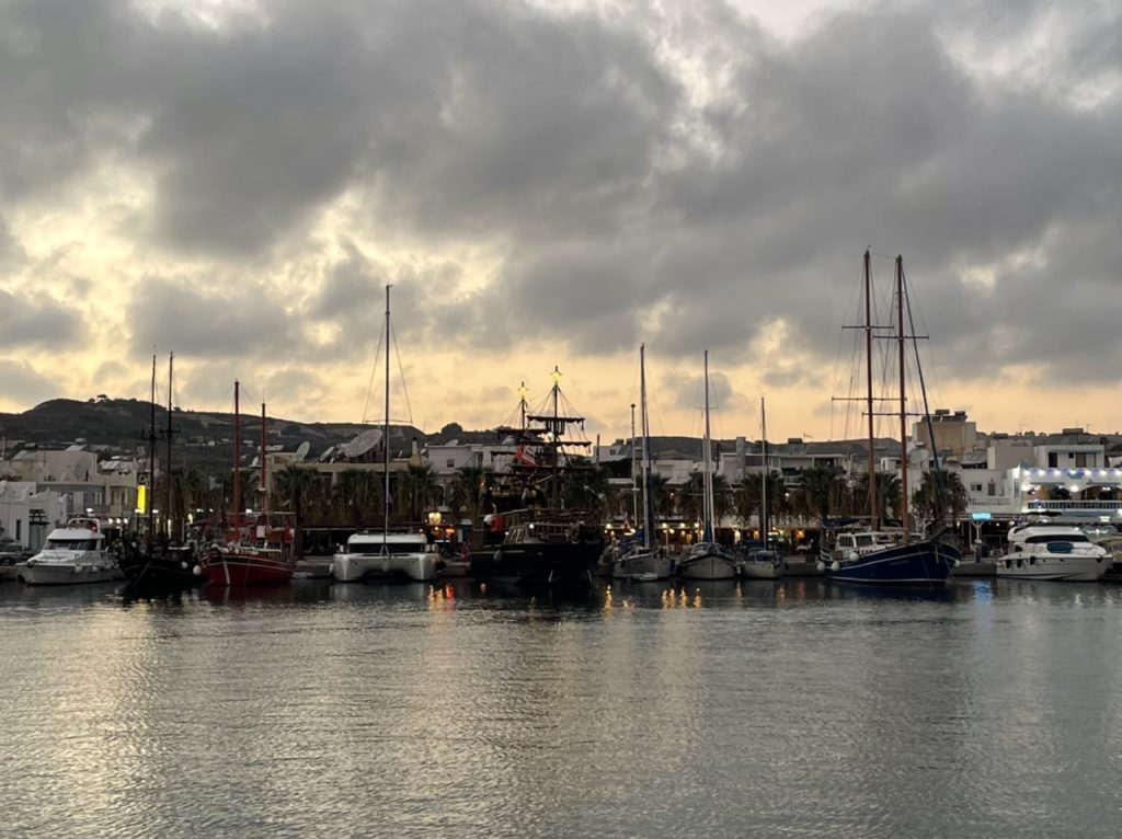
Kardamena is located in the south of Kos, with long, beautiful sandy beaches to the west and east. However, since Kos has an airport with direct flights from many German and English destinations, there are many huge hotel castles near these beaches. The nice little village with its likewise small harbour is virtually overrun by tourists when the excursion boats leave for the volcanic island of Nisyros in the morning - the same picture back in the evening. But the village has largely kept its nice character and we liked it. 

Above the village, a 5km walk through olive groves and bare macchia-grown rugged volcanic landscape inhabited only by goats, lies the Johannite fortress of Antimachia, with a wide view over the sea - and over the hotel castles. At the entrance is a Greek man in classic Efzone costume who explains some of the history to us. 

Here in Kardamena, Claudia's sailing time with us was over, her friend Pepi came from Thessaloniki and they both went to Kalymnos to hike.

When we left for Astypaleia after a few days, we had to leave (early because of the long distance) before the excursion ships styled as pirate ships and it came as it had to: an excursion ship had laid its anchor over our chain when mooring the evening before and we were stuck. Gisela, who now has a lot of experience with anchor salad in Vathys on Kalymnos, directed our boat, which was stuck in the harbour, forwards, backwards, to the right and to the left until our anchor had slid out from under the other chain. Meanwhile, the captain of the excursion boat stood on his bridge and watched the spectacle. After half an hour we were free and off we went towards Astypaleia. 

Kardamena has a decisive advantage, which is another reason why we liked it here: You pay neither mooring fees nor water nor electricity - everything is free. It was easy for us to put up with the fact that all the big screens in the bars and kafenions were showing the celebrations for Queen Elizabeth's funeral for a whole day.

[ngg src="galleries" ids="37" display="basic_slideshow"]

Kardamena liegt im Süden von Kos, westlich und östlich erstrecken sich lange schöne Sandstrände. Seit Kos allerdings einen Flughafen hat, der von vielen deutschen und englischen Destinationen direkt angeflogen wird, gibt es bei diesen Stränden viele riesige Hotelburgen. Das nette kleine Dorf mit seinem ebenfalls kleinen Hafen wird von Touristen geradezu überrannt, wenn morgens die Ausflugsschiffe zur Vulkaninsel Nisyros starten -  dasselbe Bild abends zurück. Aber das Dorf hat sich seinen netten Charakter weitgehend bewahrt und es hat uns gefallen. 

Oberhalb des Dorfes, 5km Fußweg durch Olivenhaine und kahle macchiabewachsene nur von Ziegen bewohnte zerklüftete Vulkanlandschaft liegt die Johanniterfestung Antimachia, mit weitem Blick über das Meer - und über die Hotelburgen. Am Eingang steht ein Grieche mit klassischer Efzonen-Tracht, der uns einiges aus der Geschichte erklärt. 

Hier in Kardamena war Claudias Segelzeit mit uns zu Ende, ihr Freund Pepi kam aus Thessaloniki und beide fuhren nach Kalymnos zum Wandern.

Als wir dann nach einigen Tagen in Richtung Astypaleia aufbrachen, mussten wir (früh wegen der  langen Strecke) vor den auf Piratenschiff gestylten Ausflugsschiffen los und es kam, wie es kommen musste: ein Ausflugsschiff hatte seinen Anker beim Anlegen am Vorabend über unsere Kette gelegt und wir hingen fest. Gisela, die in Vathys auf Kalymnos viel Erfahrung mit Ankersalat gemacht hatte, dirigierte unser im Hafen festhängendes Boot so lange nach vorwärts, rückwärts, nach rechts und links, bis unser Anker sich unter der anderen Kette herausgeschoben hatte. Derweil stand der Kapitän des Ausflugsschiffes auf seiner Brücke und beobachtete das Schauspiel. Nach einer halben Stunde waren wir frei und es ging los Richtung Astypaleia. 

Kardamena hat einen entscheidenden Vorteil, auch deshalb hat es uns hier ganz gut gefallen: Man zahlt weder Liegegebühr noch Wasser noch Elektrizität - alles frei. Da konnten wir es auch leicht ertragen, dass auf allen Großbildschirmen in den Bars und Kafenions einen ganzen Tag lang die Feierlichkeiten zur Beerdingung von Queen Elizabeth liefen.

[ngg src="galleries" ids="37" display="basic_slideshow"]

We would have liked to visit the island of Symi in the southeast of the Dodecanese. However, the wind forecast told us that the wind would first turn to the west in the next few days and then to the north a few days later with increasing strength. As we wanted to be back on Kos on 16.9, we decided to head north again from Nisyros sooner. With a south-westerly wind, we were able to reach the small island of Pserimos between Kos and Kalymnos in one day. In the large Ormos Vathy, which is well protected against north and west winds, we found a nice anchorage. Going for a swim in the turquoise, clear water, no artificial light in the evening, just the moon and the starry sky and in the distance the lights on the Turkish coast. Once again, pure idyll. 

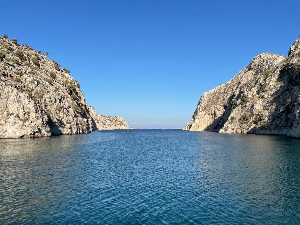
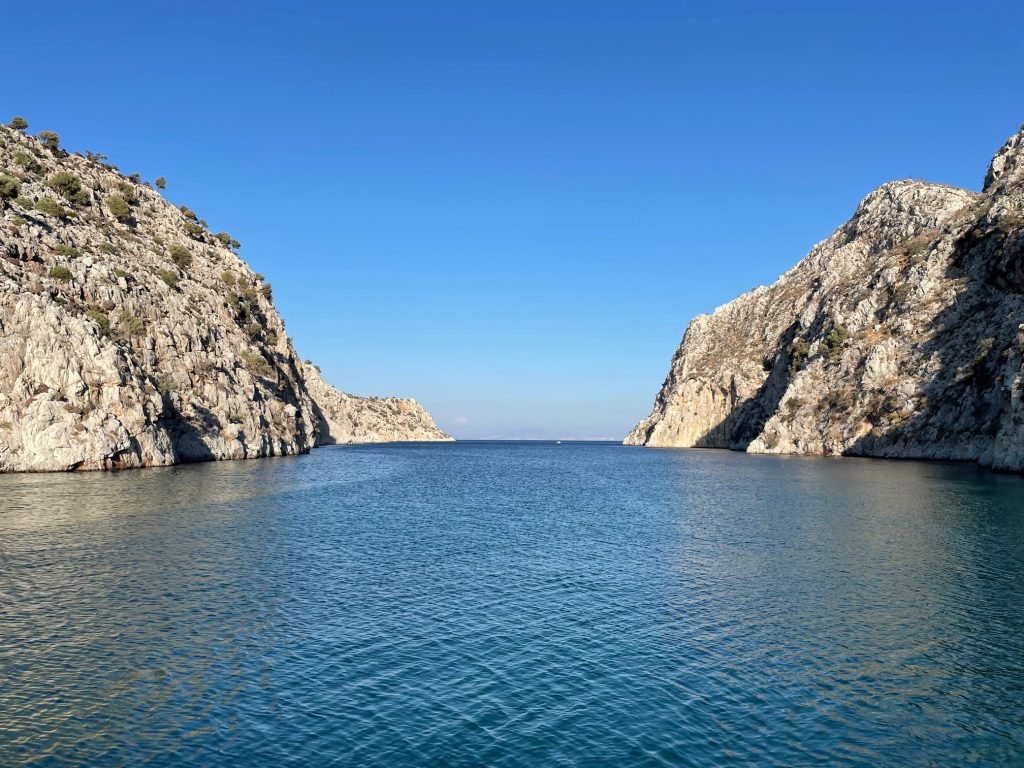
But we knew that in two days the Meltemi would start blowing again. We still had one, at most two days to get further north. Next destination: the small harbour of Vathys in the south-east of Kalymnos. In the narrow entrance to the harbour, we had the feeling we were driving into a fjord, deep water, steeply rising rocks. When we arrived at noon, most of the excursion boats were about to cast off, but it was still very narrow. The anchor had to drop just in front of the rock face opposite the pier. At the first attempt we caught the anchor chain of another boat, which we only got rid of with a lot of strength and endurance. And then it was too shallow for our boat just before the pier. So we had to stay with long stern lines and wait until we could go alongside the small pier of the excursion boats in the late afternoon. "Tomorrow at eleven o'clock you have to be gone," the harbour master tells us, wearing a large natural sponge as a headdress. Kalymnos is the island of the sponge divers. We liked Vathys very much: the fjord, the small village, which becomes quiet after the departure of the excursion boats from Kos, the friendly, almost warm-hearted locals. A place to stay for a few days. But we were supposed to be gone by eleven o'clock and besides, it gets uncomfortable there when the Meltemi blows down the valley.

Actually, we wanted to go one bay further north (Ormos Palaios) the next day, before the north wind really got going, because there are mooringtons. But when we left the fjord of Vathys, we were met by 40 knots of wind with a swell of up to two metres. We didn't want to do that to ourselves, even for a short distance. So we turned around and headed for Pserimos, the large anchorage we already knew. The way there was short and hard, a roller coaster with broken glass. We will have to get five new wine glasses soon. With gusts to over 30 knots, but no swell, we were quite happy with our choice of anchorage. Now the wind blows unabated, but all is well.  

Pictures:

[ngg src="galleries" ids="35" display="basic_slideshow"]

Gerne hätten wir als Nächstes noch die Insel Symi ganz im Südosten des Dodekanes besucht. Die Windvorhersage sagte uns aber, dass der Wind in den nächsten Tagen erst auf West und einige Tage später mit zunehmender Stärke auf Nord drehen würde. Da wir am 16.9. wieder auf Kos sein wollten, beschlossen wir, uns von Nisyros aus eher wieder nach Norden zu begeben. Mit südwestlichem Wind konnten wir so in einer Tagesfahrt gut die kleine Insel Pserimos zwischen Kos und Kalymnos erreichen. In der großen, gegen Nord- und Westwind gut geschützten Ormos Vathy fanden wir einen schönen Ankerplatz. Schwimmen gehen im türkisfarbenen, klaren Wasser, am Abend kein künstliches Licht, nur der Mond und der Sternenhimmel und in der Ferne die Lichter an der türkischen Küste. Mal wieder Idylle pur. 

Aber wir wussten, dass in zwei Tagen der Meltemi wieder anfangen würde zu blasen. Einen, maximal zwei Tage hatten wir noch, um weiter nach Norden zu kommen. Nächstes Ziel: der kleine Hafen von Vathys im Südosten von Kalymnos. In der engen Einfahrt zum Hafen hatten wir das Gefühl, wir fahren in einen Fjord, tiefes Wasser, steil aufragende Felsen. Als wir mittags ankamen, waren zwar die meisten Ausflugsboote dabei, abzulegen, aber es war trotzdem sehr eng. Der Anker musste knapp vor der Felswand gegenüber der Pier fallen. Beim ersten Anlauf erwischten wir gleich mal die Ankerkette eines anderen Bootes, die wir nur mit viel Kraft und Ausdauer wieder loswurden. Und dann war es knapp vor der Pier zu flach für unser Boot. Also hieß es: mit langen Heckleinen liegen bleiben und warten, bis wir am späten Nachmittag längsseits an die kleine Pier der Ausflugsboote gehen konnten. „Morgen um elf Uhr müsst ihr weg sein,“ sage uns der Hafenmeister, der einen großen Naturschwamm als Kopfputz trägt. Kalymnos ist die Insel der Schwammtaucher. Vathys hat uns gut gefallen: der Fjord, der kleine Ort, in den nach Abfahrt der Ausflugsboote von Kos Ruhe einkehrt, die freundlichen, ja fast herzlichen Einheimischen. Ein Ort, um ein paar Tage zu bleiben. Aber wir sollten ja um elf Uhr weg sein und außerdem wird es dort ungemütlich, wenn der Meltemi das Tal herunter bläst.

Eigentlich wollten wir uns am nächsten Tag, bevor es so richtig losgeht mit dem Nordwind, noch eine Bucht weiter nach Norden begeben (Ormos Palaios) und dort an einer Muringtonne den Wind abwettern. Als wir aber aus dem Fjord von Vathys herausfuhren, kamen uns 40 Knoten Wind mit einer Dünung von bis zu zwei Metern entgegen. Das wollten wir uns auch für eine kurze Strecke nicht antun. Also Kehrtwendung mit Ziel Pserimos, in die große Ankerbucht, die wir ja schon kannten. Der Weg dorthin war kurz und heftig, Achterbahn mit Scherben. Fünf neue Weingläser müssen wir uns demnächst besorgen. Bei Böen bis über 30 Knoten, aber ohne Schwell waren wir ganz zufrieden mit der Wahl unseres Ankerplatzes. Jetzt bläst der Wind unverdrossen, aber alles ist gut.  

Bilder:

[ngg src="galleries" ids="35" display="basic_slideshow"]

After welcoming our friend Claudia, an experienced sailor and area expert, on board, we set off south in a north-westerly wind between three and five bft. Our destination: the small volcanic island of Nisyros. Now there are three of us and setting and hoisting the sails, which is labour-intensive on Aglaya, is much quicker. After a beautiful day of sailing, we find a place in the harbour of Pali right next to the fishermen, from whom we can buy fish directly from the boat on one of the next days. It is Thursday and the harbour is already full of boats, mainly charter boats, which will probably all have to be back in the marinas tomorrow evening. And it gets even more crowded. Later, there are two more boats in the packet with us. The next day, however, it becomes emptier again.

The island of Nisyros is described in the guidebook as a natural wonder. We spend a day on the island, first with the island bus to the main town of Mandraki. Then we are allowed to ride in the bus of a Polish tour group and can take a look at the large volcanic crater (one of the largest in Europe). Mountains up to 700 metres high rise directly from the sea. Under the floor of the crater, which is only 120 metres above sea level, it is still bubbling. Here we learn a lot about volcanism in the region, to which Santorini also belongs. As we descend to the bottom of the crater, it gets even hotter than it already is, and there is a smell of sulphur. Back in Mandraki, we climb up to Paleokastro via a beautiful stone-paved and wall-lined path. Here, too, we are quite impressed: the well-preserved walls are made of huge stone blocks and the view to the surrounding islands and the Turkish mainland is magnificent. Archaeologists still have a lot of work to do here, because the inside of the castro has not yet been uncovered. It is not known whether the walls of an acropolis are here or whether they are fortress walls.   

[ngg src="galleries" ids="33" display="basic_slideshow"]