Springe zum Inhalt

At first, we hesitated to reserve a berth in Kavala. For our boat, it was 81 euros per night without water and electricity, and no shower or toilet. But then the price went down in the off-season. So we were able to visit this great city with its impressive fortress, beautiful old town and lively atmosphere directly by boat. Natasha made up for the poor infrastructure for sailors by taking care of everything for us: mooring, bunkering diesel before winter storage... a wonderful, professional woman working on behalf of the Port Authority. We hope she gets a cut of the hefty mooring fees.

Kavala, the largest city in Eastern Macedonia, used to be a transshipment point for tobacco that came from Turkey, was stored here and then transported on to the Balkans. This was obviously a lucrative business, as evidenced by the villas of the tobacco barons that still stand today. 

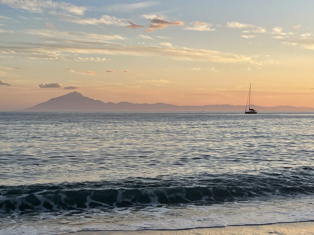
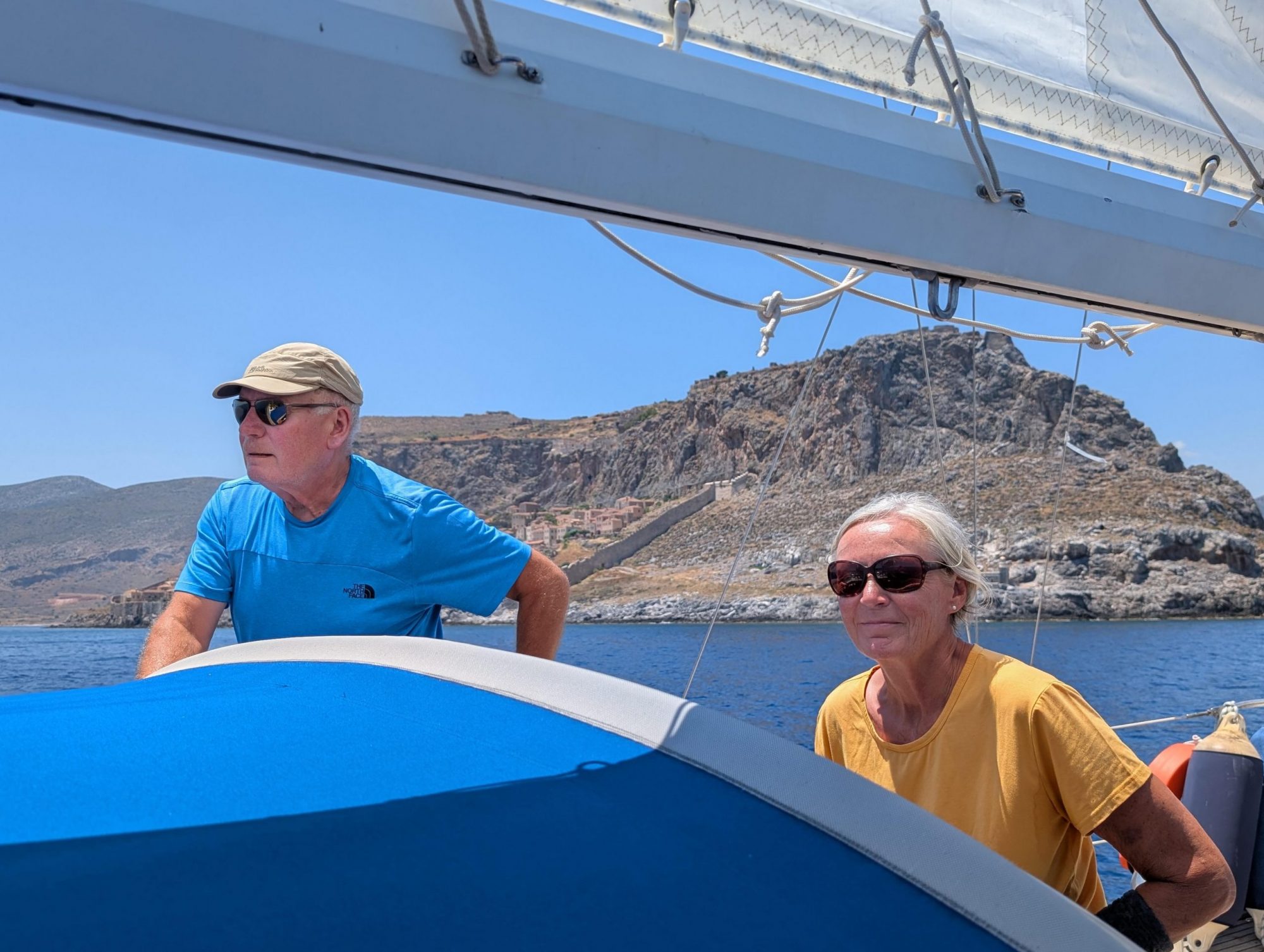
The fortress towers directly above the harbour. From the cockpit, we admired it in every light of day and night. Of course, we also climbed up. From the tower, there is a magnificent panoramic view over the city, the harbour, to Thassos and as far as Mount Athos. Another special eye-catcher is the two-storey viaduct, through which water was transported into the city in earlier times.

[ngg src="galleries" ids="181" display="basic_slideshow"]

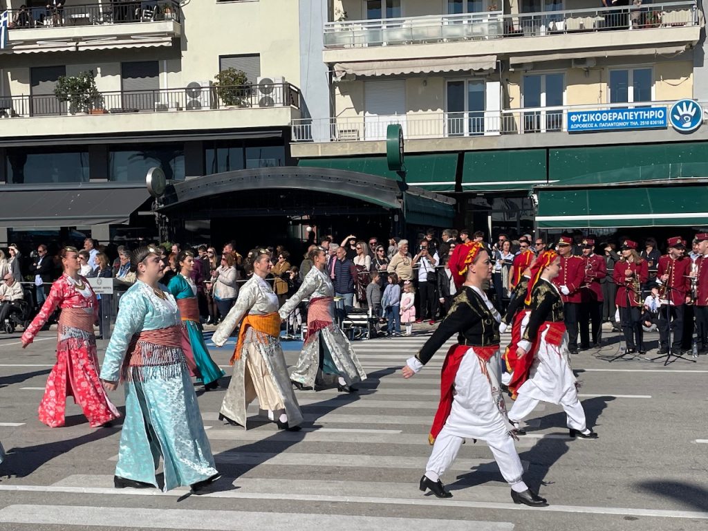
And then there was Oxi Day, Greece's national holiday on 28 October. We have experienced it several times in other places, and it is always a big spectacle, even though it has a serious and, for the Greeks, very painful origin (https://du-bist-grieche.de/28-oktober-der-tag-des-nein-in-griechenland-ochi-tag/19366781: speeches, music and a parade. This time we were in Kavala, delighted by the many children and young people in the parade and the women and men in their very different traditional costumes. So many young people and such diversity are visible here. Where can you see that at home? It's also nice to watch the people watching the parade. They gather for this big event, arrange to meet up and then usually find each other thanks to their mobile phones. Parents and grandparents who are proud that their children and grandchildren are taking part in the parade. Sometimes we also get into conversation with someone. And whenever the city's dignitaries pass by and a person raises their right hand (often wearing a white glove), we are reminded of the occasion of this day in 1940. We are so glad that, since we have been travelling in Greece, we have always been welcome everywhere as Germans.

[ngg src="galleries" ids="182" display="basic_slideshow"]

We have now arrived at our winter mooring for our boat, just west of Kavala in Nea Peramos. It's another new experience to go ashore here.
Erst einmal hatten wir gezögert, einen Liegeplatz in Kavala zu reservieren. Für unser Boot 81 Euro pro Nacht ohne Wasser und Strom, keine Dusche und Toilette. Aber dann ging der Preis runter, Nachsaison. So konnten wir diese tolle Stadt mit ihrer eindrucksvollen Festung, ihrer schönen Altstadt und dem quirligen Leben doch direkt mit dem Boot besuchen. Ein Ausgleich für die schlechte Infrastruktur für Segler war Natasha, die sich um alles für uns gekümmert hat: Liegeplatz, Diesel bunkern vor dem Winterlager … eine tolle, professionelle Frau, unterwegs im Auftrag der Port Authority. Wir hoffen, sie bekommt etwas ab von den fetten Liegegebühren.

Kavala, die größte Stadt in Ostmakedonien war früher ein Umschlagplatz für Tabak, der aus der Türkei kam, hier gelagert und dann weiter auf den Balkan transportiert wurde. Damit konnte man offensichtlich gut Geld verdienen. Davon zeugen auch heute noch die Villen der Tabakbarone. 

Die Festung thront direkt über dem Hafen. Vom Cockpit aus haben wir sie bei jedem Tages- und Nachtlicht bewundert. Natürlich sind wir auch hochgestiegen. Vom Turm aus ein grandioser Rundumblick, über die Stadt, den Hafen, nach Thassos und bis zum Berg Athos. Ein besonderer Eyecatcher ist auch das zweistöckige Viadukt, durch das in früheren Zeiten das Wasser in die Stadt transportiert wurde.

[ngg src="galleries" ids="181" display="basic_slideshow"]

Und dann der Oxi-Day, griechischer Nationalfeiertag am 28. Oktober. Wir haben ihn ja schon mehrfach an anderen Orten erlebt, immer ein großes Spektakel, obwohl er ja einen ernsten, für die Griechen sehr leidvollen Anlass hat https://du-bist-grieche.de/28-oktober-der-tag-des-nein-in-griechenland-ochi-tag/19366781: Ansprache, Musik und eine Parade. Dieses Mal waren wir in Kavala dabei, haben uns über die vielen Kinder und Jugendlichen bei der Parade gefreut und über die Frauen und Männer in ganz unterschiedlichen Trachten. So viele junge Menschen und solch eine Vielfalt wird hier sichtbar. Wo gibt es das bei uns zu Hause zu sehen? Schön auch, die Menschen zu beobachten, die der Parade zuschauen. Die sich zu diesem großen Happening einfinden, verabredet haben und dann dank Handy meist auch finden. Eltern und Großeltern, die stolz darauf sind, dass ihre Kinder und Enkel bei der Parade mitmachen. Manchmal kommt auch mit jemandem ins Gespräch. Und immer, wenn beim Passieren der Honoratioren der Stadt von einer Person die rechte Hand (oft mit weißem Handschuh) nach oben geht, werden wir an den Anlass dieses Tages im Jahr 1940 erinnert. Wir sind so froh, dass wir, seit wir in Griechenland unterwegs sind, als Deutsche immer und überall willkommen waren.

[ngg src="galleries" ids="182" display="basic_slideshow"]

Nun sind wir inzwischen an unserem Winterplatz für unser Boot angekommen, etwas westlich von Kavala in Nea Peramos. Wieder eine neue Erfahrung, hier an Land zu gehen.

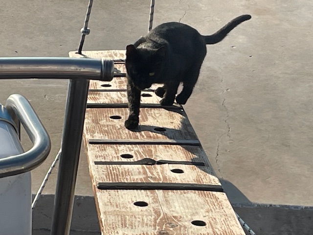
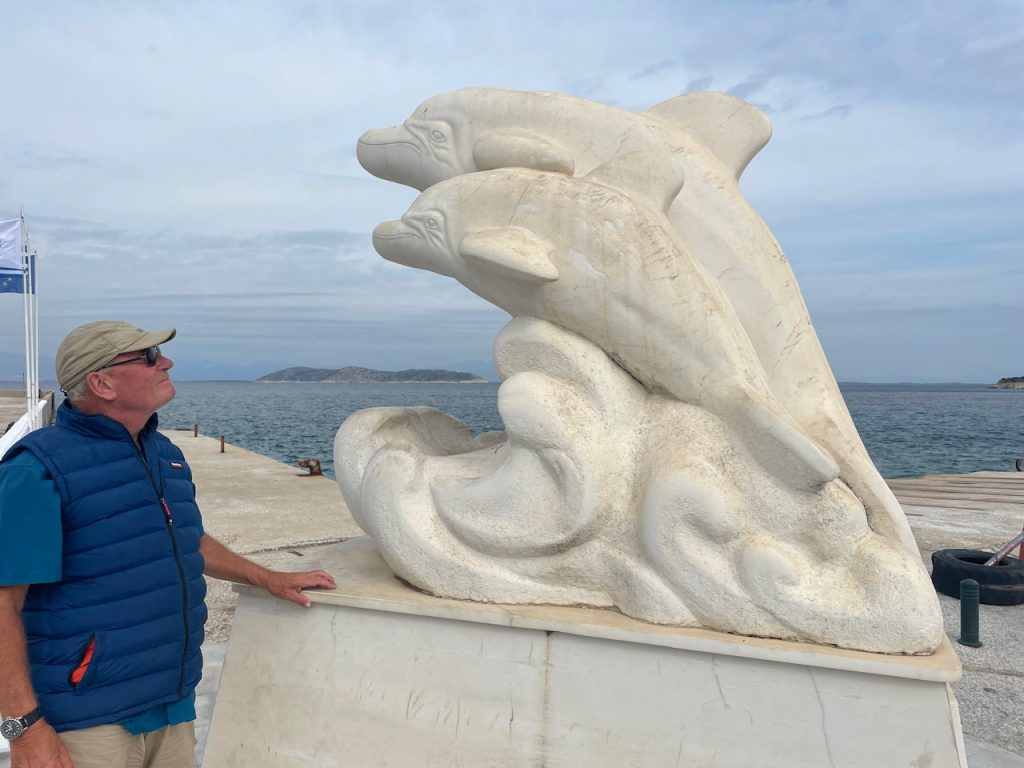
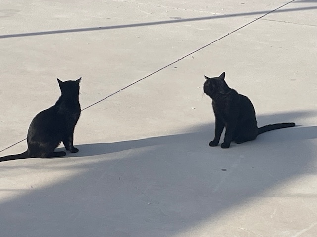
It is well known that marble has been quarried on Thassos since ancient times. Driving across the island in a hire car, we see quarries in the mountains, but also right by the sea. However, it is in the harbour of Limenária that we discover that there are also an unusually large number of black cats on this island. They are everywhere, coming on board with us and jumping onto our laps when we drink beer on the beach in the evening.

In the harbour of Limenária, we are protected by a bow anchor with our stern at the pier. It is a good place to leave the boat to explore the island. There is no harbour authority, no shore power and no other infrastructure for sailors. But there is water at the pier, so we can thoroughly clean our deck of sand, Posidonia and salt from the breakers of Samothraki. Here we finally free our ‘Adenauer’, which had become stuck at the top of the besan mast.

Limenária is an old mining town. The first official rights to mine iron, zinc, lead and silver ore were granted to the Speidel company from Pforzheim in 1903. At that time, the island was still under Turkish administration. The Speidelschlösschen, which has been uninhabited since 1964, towers directly above the harbour. Unfortunately, it is not being maintained. We took a look at the old mining facilities and also at the ‘Crown of Limenária’, twelve marble slabs arranged in a circle, which were designed by pupils from the Stuttgart Waldorf School.

Pictures of Limenária and the surrounding area

[ngg src="galleries" ids="177" display="basic_slideshow"]

The weather continues to be very changeable, cool, cloudy and rainy at times. But that didn‘t stop us from exploring the island further. We drive along the south coast in a hire car for a day, climbing down the steep rocks to a special bathing spot (Gióla) between the cliffs. Along the rugged marble coast and beautiful sandy beaches, we continue past the Archangélou monastery to the Alikí peninsula. We walk around it and admire the large marble blocks right by the sea and the remains of the sacred sites from Byzantine and Roman times.

Pictures of Gióla an Alikí

[ngg src="galleries" ids="178" display="basic_slideshow"]

We take the local bus for a day trip to Liménia/Thassos on the north side. There is a busy ferry service here to Keramoti on the mainland. In the old naval port, where fishing boats are now moored, we enjoy the breakfast we brought from the baker (spinach pies and tomato and cheese pies). There are many ancient ruins to discover right in the town. And up in the forest above the town, we marvel at the amphitheatre, made entirely of white marble, which is currently being restored.

Pictures of Liménia

[ngg src="galleries" ids="179" display="basic_slideshow"]

When it becomes sunnier and warmer again, we put on our hiking boots, take the bus to the mountain village of Theológos and walk along the Dipótamos stream bed down to the coast. A very well-marked trail takes us almost eleven kilometres through varied terrain, sometimes along stone walls through olive groves, then through oak and plane tree forests and through pine trees and heather. In Germany, such a well-maintained, beautiful trail would be classified as a ‘premium hiking trail’. Apart from goats and sheep, we didn't meet anyone here.

Pictures of Theológos and hiking

[ngg src="galleries" ids="180" display="basic_slideshow"]

Today we are treating ourselves to another day in the harbour before setting sail for Kavala on the mainland tomorrow.

Dass auf Thassos schon seit der Antike Marmor abgebaut wird, ist bekannt. Bei einer Fahrt mit dem Leihwagen über die Insel sehen wir Steinbrüche in den Bergen, aber auch direkt am Meer. Dass es aber auf dieser Insel auch ungewöhnlich viele schwarze Katzen gibt, erfahren wir im Hafen von Limenária. Sie sind überall unterwegs, kommen zu uns an Bord und springen uns auf den Schoß, wenn wir abends am Strand ein Bier trinken.

Im Hafen von Limenária liegen wir geschützt vor Buganker mit dem Heck an der Pier. Ein guter Platz, um von hier aus die Insel zu erkunden. Hier gibt es keine Hafenbehörde, keinen Landstrom und auch sonst keine Infrastruktur für Segler. Aber es gibt Wasser an der Pier, so dass wir unser Deck noch einmal gründlich von Sand, Posidonia und Salz aus den Brechern von Samothraki säubern können. Hier befreien wir endlich auch unseren „Adenauer“, der sich an der Spitze des Besammastes festgeklemmt hatte.

Limenária ist eine alte Bergbaustadt. Die ersten offiziellen Rechte für den Abbau von eisen-, zink-, blei- und silberhaltigem Gestein wurden 1903 an die Firma Speidel aus Pforzheim vergeben. Da stand die Insel noch unter türkischer Verwaltung. Das Speidelschlösschen, das seit 1964 nicht mehr bewohnt wird, thront direkt über dem Hafen. Leider wird es nicht instand gehalten. Die alten Anlagen aus der Bergwerkszeit haben wir uns natürlich angeschaut und auch die „Krone von Limenária“, zwölf zu einem Kreis angeordnete Marmortafeln, die von Schülern der Stuttgarter Waldorfschule gestaltet wurden.

Bilder von Limenária und Umgebung

[ngg src="galleries" ids="177" display="basic_slideshow"]

Das Wetter ist weiterhin sehr unbeständig, kühl, viele Wolken und ab und zu Regen. Das hält uns aber nicht davon ab, die Insel weiter zu erkunden. So fahren wir mit einem Leihwagen einen Tag lang die Südküste entlang, steigen die steilen Felsen zu einem besonderen Badeplatz (Gióla) zwischen den Klippen hinunter. Entlang der schroffen Marmorküste und schönen Sandstränden geht es dann weiter vorbei am Kloster Archangélou zur Halbinsel Alikí. Wir umrunden sie zu Fuß und bewundern die großen Marmorblöcke direkt am Meer und die Überreste der heiligen Stätten aus byzantinischer und römischer Zeit.

Bilder von Gióla und Aliki

[ngg src="galleries" ids="178" display="basic_slideshow"]

Mit dem lokalen Bus fahren wir für einen Tag auf die Nordseite nach Liménia/Thassos. Hier herrscht reger Fährverkehr zum Festland nach Keramoti. Im alten Kriegshafen, in dem heute die Fischerboote liegen, lassen wir uns das vom Bäcker mitgebrachte Frühstück schmecken (Spinattasche und Tomatenkäsetasche). Direkt in der Stadt gibt es viele Überreste aus der Antike zu entdecken. Und oben im Wald über der Stadt bestaunen wir das Amphitheater, ganz aus weißem Marmor, das gerade restauriert wird.

Bilder von Liménia

[ngg src="galleries" ids="179" display="basic_slideshow"]

Als es wieder sonniger und wärmer wird, ziehen wir unsere Wanderschuhe an, fahren mit dem Bus in das Bergdorf Theológos und laufen am Bachbett des Dipótamos entlang hinunter bis zur Küste. Auf einem sehr gut markierten Pfad geht es fast elf Kilometer durch abwechslungsreiches Gelände, mal an Steinmäuerchen entlang durch Olivenhaine, dann durch Eichen- und Platanenwälder und durch Kiefern und Heidekraut. In Deutschland würde man einen so gut angelegten, wunderschönen Weg als „Premium-Wanderweg“ einstufen. Außer Ziegen und Schafen haben wir hier niemanden getroffen.

Bilder von Theológos und vom Wandern

[ngg src="galleries" ids="180" display="basic_slideshow"]

Heute gönnen wir uns noch einen Tag im Hafen, bevor wir morgen den Bug Richtung Kavala am Festland richten. 

2

After the island initially welcomed us with strong winds and breakers that washed sand and Posidonia over our boat, we were able to discover many interesting and impressive things on the island over the following days. For example, we watched the large ferry that comes from Alexandroupoli every day manoeuvre cautiously. There was hardly any swell for our boat. And the ‘anchor manager’ at the bow waved to us every time the bow almost reached our boat. Once, however, the ferry's two bow anchors became entangled with each other. It took an hour and the help of a large fishing boat to resolve the problem. 

[ngg src="galleries" ids="171" display="basic_slideshow"]

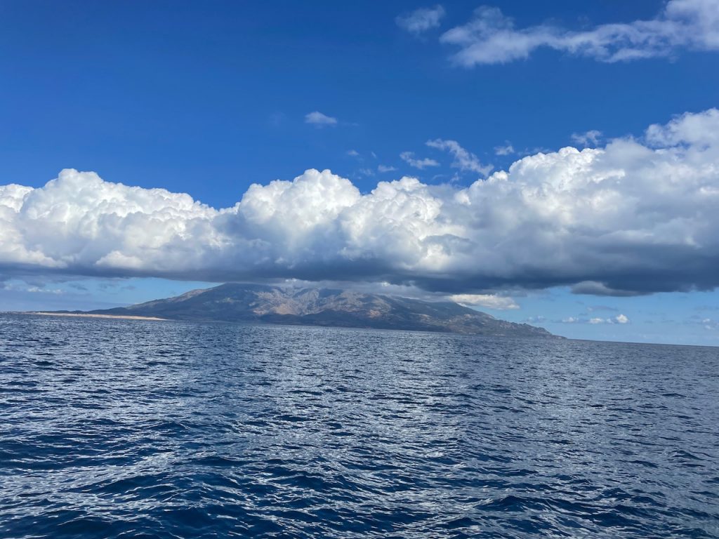
Samothraki, located in the far north-east of the Aegean Sea, is different from the more southerly Aegean islands. High mountains with rugged cliffs that plunge directly into the sea, bizarre rock formations. At 1600 metres, Fengari is the highest mountain. The north side of the island is green. Here you can hike through plane tree and oak forests to various waterfalls.

There is always something going on in the main town of Kamariotissa when the ferry arrives.

We travelled by bus and on foot. We visited the town of Therma with its sulphur springs, looked at the small harbour and decided not to go there with our boat. The harbour entrance is extremely narrow and the harbour quite shallow.

Pictures of Therma

[ngg src="galleries" ids="172" display="basic_slideshow"]

We were particularly impressed by the sanctuary of the Great Gods. In the third century BC, the great gods met here and performed mystical rites to make the world a better place and ensure divine protection at sea. It takes time to walk around the large complex and reach the spot where the Nike of Samothrace was found. In the beautifully designed museum, we were able to marvel at many well-preserved finds. 

Pictures of the Sanctuary of the Great Gods  

[ngg src="galleries" ids="173" display="basic_slideshow"]

The old capital, Chora of Samothrace, is located in the mountains. Almost everything is closed here: the season is over.

Pictures of the Chora

[ngg src="galleries" ids="174" display="basic_slideshow"]

The southwest of the island is rural. With a view of the high mountains, we walked through mown fields, past small farms with goats, sheep and geese, and sometimes military installations. Turkey is not far away.

Pictures from the southwest

[ngg src="galleries" ids="175" display="basic_slideshow"]

To say goodbye, Gisela took a beautiful hike to the Fonias waterfalls, always along the stream bed and finally with a bit of climbing on a fixed rope.

Pictures of Fonias

[ngg src="galleries" ids="176" display="basic_slideshow"]

Yes, Samothraki has hardly any tourist infrastructure and everything is very informal. Everyone greets everyone else. So that's what we did too. The bus driver even waved to us, when he drove past in his bus.

We are now on Thassos, having made a long journey of 44 nautical miles to the west, and are currently moored in the harbour of Limenária.

Nachdem uns die Insel zuerst mit Starkwind und Brechern, die sich mit Sand und Posidonia über unser Boot ergossen, empfangen hat, konnten wir an den folgenden Tagen viel Interessantes und Beeindruckendes auf der Insel entdecken. So haben wir zum Beispiel das vorsichtige Manövrieren der großen Fähre, die jeden Tag von Alexandroupoli kommt, beobachtet. Kaum Schwell für unser Boot. Und der „Ankermanager“ vorne am Bug hat uns, wenn der Bug fast über unser Boot reichte, jedes Mal zugewinkt. Einmal allerdings haben sich die beiden Buganker der Fähre miteinander verheddert. Erst mit Hilfe eines großen Fischerbootes konnte das Problem nach einer Stunde behoben werden. 

[ngg src="galleries" ids="171" display="basic_slideshow"]

Samothraki, ganz im Nordosten der Ägäis gelegen, ist anders als die südlicheren Ägäisinseln. Hohe Berge mit schroffen Felswänden, die direkt ins Meer gehen, bizarre Felsformationen. Der Fengari ist mit 1600m der höchste Berg. Auf der Nordseite der Insel ist es grün. Hier kann man durch Platanen- und Eichenwälder zu verschiedenen Wasserfällen wandern.

Im Hauptort Kamariotissa ist immer etwas los, wenn die Fähre kommt.

Mit Bus und zu Fuß waren wir unterwegs. Wir besuchten den Ort Therma mit seinen Schwefelquellen, schauten uns den kleinen Hafen an und beschlossen, mit unserem Boot nicht dorthin zu gehen. Die Hafeneinfahrt ist extrem schmal und der Hafen recht flach.

Bilder von Therma

[ngg src="galleries" ids="172" display="basic_slideshow"]

Besonders beeindruckt hat uns das Heiligtum der Großen Götter. Im dritten Jahrhundert trafen sich hier die großen Götter und vollzogen mystische Riten, um zu bewirken, dass die Welt besser wird und es göttlichen Schutz auf See gibt. Es braucht Zeit, um die große Anlage zu erwandern und um zu der Stelle zu kommen, wo die Nike von Samothraki gefunden wurde. In dem sehr schön gestalteten Museum konnten wir viele gut erhaltene Fundstücke bestaunen. 

Bilder vom Heiligtum der großen Götter  

[ngg src="galleries" ids="173" display="basic_slideshow"]

Der alte Hauptort, die Chora von Samothraki liegt in den Bergen. Hier ist fast alles geschlossen: Saisonende.

Bilder von der Chora

[ngg src="galleries" ids="174" display="basic_slideshow"]

Der Südwesten der Insel ist ländlich. Mit Blick auf die hohen Berge sind wir hier durch abgemähte Felder gelaufen, vorbei an an kleinen Bauernhöfen mit Ziegen, Schafen und Gänsen und manchmal auch militärischen Einrichtungen. Die Türkei ist nicht weit.

Bilder vom Südwesten

[ngg src="galleries" ids="175" display="basic_slideshow"]

Zum Abschied machte Gisela noch eine schöne Wanderung zu den Fonias-Wasserfällen, immer am Bachbett entlang und zum Schluss mit etwas Kletterei am fixen Seil.

Bilder von Fonias

[ngg src="galleries" ids="176" display="basic_slideshow"]

Ja, Samothraki hat kaum touristische Infrastruktur und alles ist sehr familär. Jeder grüßt jeden. So haben wir das dann auch gemacht. Der Busfahrer winkte uns sogar, wenn er mit seinem Bus vorbei fuhr.

Inzwischen sind wir auf Thassos, haben einen langen Schlag von 44 Seemeilen nach Westen gemacht und liegen jetzt im Hafen von Limenária.

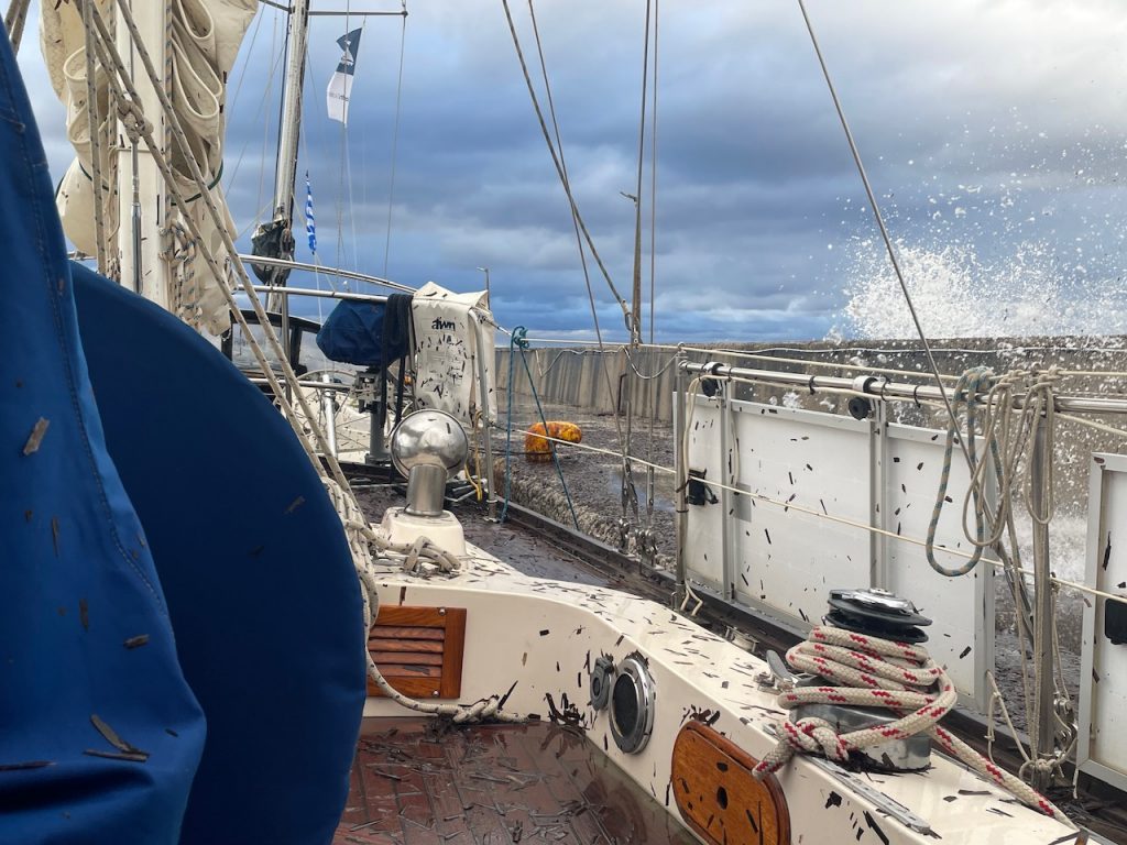
That's what we say to each other from time to time when strong winds and a restless night are forecast, when we hope that our anchor will hold. Here on Samothraki in the harbour of Kamariotissa, that's also the motto. Secure the boat well, be alert, persevere. We are moored alongside the outer pier together with several other sailing boats that have also taken refuge here from the forecast strong north wind. It is the only safe harbour on the island; the nearest harbours on other islands are at least 40 nautical miles away. And here, you can only moor alongside, as a large ferry docks in the harbour every day.

However, we didn't think it would be so violent and last so long. Twenty-four hours of strong winds of up to 40 knots, spray and breakers coming over the quay wall and pouring over our boat meant we had a sleepless night and a day on watch on board. Our lines have held so far. But the breakers are bringing lots of Posidonia onto our boat. The drains on deck are constantly clogged with it, so the water that comes over the side cannot drain away. We are waiting for the weather to calm down so we can go ashore for a coffee and to buy something for dinner. We don't even want to think about cleaning up the deck yet.

Waves come over the pier on our boat: video